TWCT Land Optimisation Investigation
Turning land information into practical pathways for more resilient, productive and sustainable whenua across Te Tairāwhiti.
Scroll to explore
Challenge
Seeing the whole whenua clearly
Recent severe weather events have reinforced the vulnerability of erosion-prone land across Te Tairāwhiti. At the same time, changing planning requirements are creating new questions for landowners about the future management of their whenua.
For TWCT, the challenge was understanding what this meant across a large and diverse portfolio of Māori land.
Information existed, but it varied considerably between properties. National datasets provided a useful starting point, while some blocks had detailed Farm Environment Plans, biodiversity assessments or previous land-use work available.
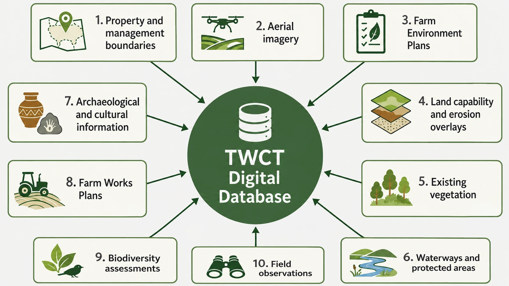
TWCT wanted to bring that information together into a consistent picture that could be viewed across the wider whenua while retaining enough detail to understand individual properties.
The purpose was not to prescribe how land should be used. It was to give landowners better information to understand their options and make informed decisions about what comes next.

Solution
Building the evidence for better land-use decisions
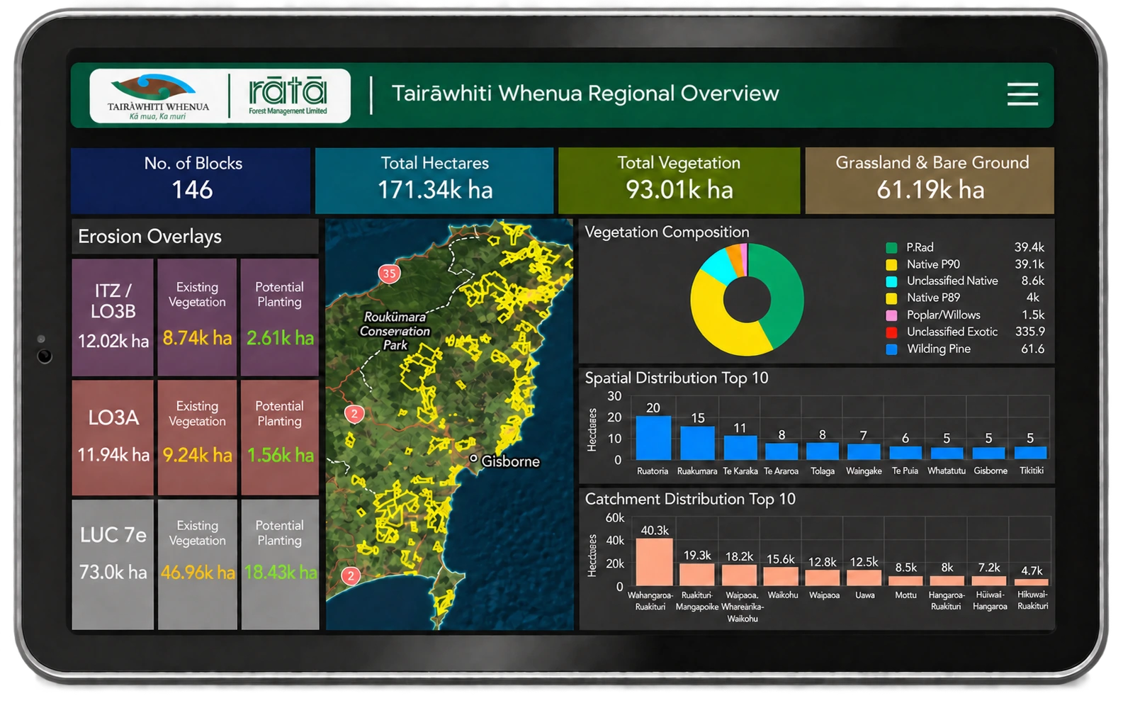
Rātā developed a consistent spatial assessment process to help TWCT build a more detailed understanding of current land use across the whenua.
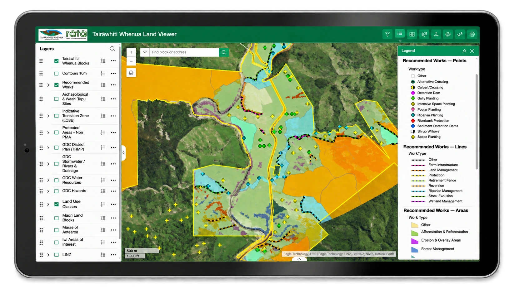
Recent aerial imagery, existing property information and Rātā’s Mātai technology were combined to identify features including pasture, native vegetation, commercial forestry, erosion and other land-use considerations. The outputs were then reviewed alongside available property information and Rātā’s specialist knowledge.
The analysis was used to identify areas where alternative management could warrant further investigation. Depending on the whenua, potential pathways included erosion-control and riparian planting, permanent vegetation, productive forestry and other planting options.
Indicative ETS opportunities and financial scenarios were also considered where appropriate, allowing potential environmental benefits to be viewed alongside establishment costs, ongoing management and possible returns.
Rather than producing a single prescribed answer, the analysis helps landowners understand the choices and trade-offs between environmental outcomes, productive use, financial considerations and their own aspirations for the whenua.
Where more detailed information is available, including field observations and biodiversity or property-level assessments, it can be incorporated to refine the analysis. The process can also be updated as new information becomes available.

Impact
A stronger evidence base for what comes next
TWCT is developing a common land-use evidence base that can be understood at two levels: across its wider network of whenua and at individual property level.
For landowners, that provides a clearer starting point for understanding their whenua, investigating opportunities and deciding whether more detailed assessment is worthwhile.
For TWCT, the collective picture creates something equally important. It helps identify broader patterns, shared challenges and potential opportunities that may not be visible when properties are considered individually.
That evidence can support discussions about investment, land-use transition, environmental resilience and the practical support Māori landowners need from local and central government and funding partners. This aligns with TWCT’s wider emphasis on owner-led decisions that balance productive returns, cultural values, environmental outcomes and long-term resilience.
The opportunities identified remain indicative. Any future land-use change would require further site-specific assessment and, importantly, decisions by the landowners themselves.