Mātai | Artificial Spatial Intelligence
Rātā developed Mātai, an in-house geospatial AI capability that supports specialists by reducing repetitive spatial processing and creating more time for review, refinement and higher-value land-use analysis.
Scroll to explore
Challenge
Large ETS and land-use projects required extensive manual digitisation across significant areas, creating pressure on specialist time and project delivery.
Large-scale ETS and land-use projects can require significant amounts of manual spatial analysis.
Before Mātai was developed, Rātā specialists could spend hours or even days reviewing aerial imagery, digitising groups of trees and identifying areas that required further assessment for potential ETS eligibility.
This became particularly challenging during a major programme in which approximately 81,000 hectares of land was submitted to Rātā for processing.
The work was also being undertaken within strict timeframes. The ETS Mandatory Emissions Return Period ended on 31 December 2025, creating a clear deadline for landowners seeking to preserve the ability to claim eligible units back to 1 January 2023. The project itself also contained a series of delivery milestones that had to be met.
With large areas to assess and finite specialist capacity, Rātā needed a more efficient way to support the initial spatial-analysis workload.

Solution
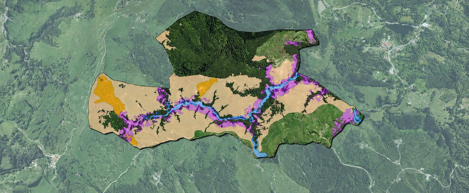
Rātā developed Mātai, an in-house geospatial AI capability designed to support spatial specialists by identifying and mapping candidate land-cover features for further review.
Rātā responded by developing Mātai, an in-house geospatial AI capability designed to support its specialists.
Mātai assists with the identification and mapping of land-cover features from aerial imagery, reducing the amount of repetitive manual digitisation required at the beginning of the assessment process.
The first version of Mātai was developed alongside the original project and remained experimental while Rātā tested whether the concept could provide useful operational results.
Although Mātai V1 was not used across the majority of the 81,000-hectare programme, it demonstrated that processes which could previously take days could, in some cases, be reduced to hours.
Once the capability had been proven, Rātā approved the development of a more robust production version.
Mātai was subsequently used during a larger land-use project involving approximately 180,000 hectares, providing Rātā with a practical way to support spatial analysis at a substantially greater scale.
Importantly, Mātai does not replace specialist judgement. Its outputs are reviewed by Rātā’s technical team, who remain responsible for validating results, refining boundaries, interpreting complex areas and determining how the information should be used within ETS and other land-management workflows.
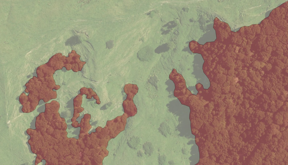
- MātaiAI-assisted mapping
What is Mātai?
Mātai is Rātā’s spatial intelligence platform. It uses AI-assisted mapping to identify land-cover features, helping our specialists analyse whenua faster and develop recommendations informed by professional judgement and local knowledge.
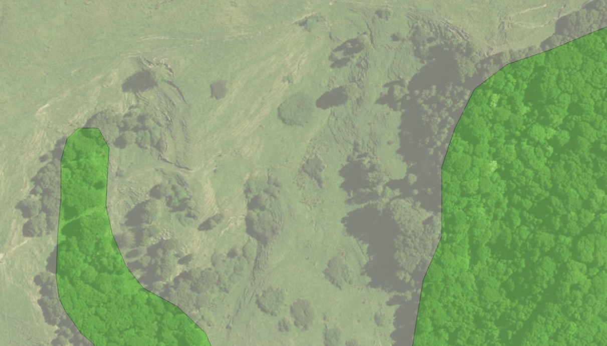
- LCDBExisting classification
What is LCDB?
LCDB stands for Land Cover Database. It is a national map of New Zealand’s land cover, classifying features such as forest, grassland, water and built-up areas and recording changes over time.

Impact
Mātai reduced the burden of repetitive digitisation, improved Rātā’s ability to work at scale and created more time for specialists to focus on interpretation, refinement and the quality of final deliverables.
The greatest impact of Mātai has been a change in how specialist time is used.
By reducing the amount of repetitive digitisation required, Mātai allows Rātā’s specialists to spend more time reviewing, refining and adding detail to project outputs rather than manually creating every spatial feature from the beginning.
This has improved Rātā’s ability to manage large spatial-analysis workloads while maintaining specialist oversight throughout the process.
The development of Mātai has also created a reusable internal capability for the business.
What began as a response to the demands of a single ETS project has evolved into an in-house tool that can support future ETS, forestry and land-use work.
Mātai demonstrates how Rātā is using technology to strengthen—not replace—specialist expertise, creating more efficient workflows while keeping professional judgement at the centre of the final outcome.